|
ATLANTIC OCEAN - TRIALS
Please use our A-Z INDEX to navigate this site or return HOME
|
|
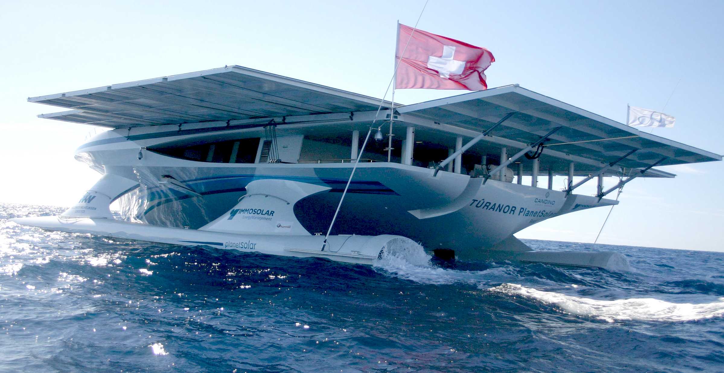
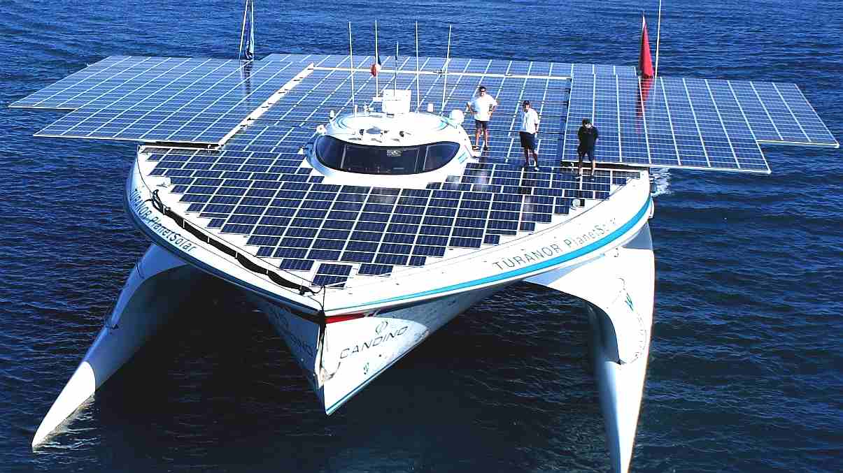
PlanetSolar heading out into uncharted technical waters. The theory was in place, but nobody knew if this solar powered boat could make it. But they did! The solar panel area on this ship was increased with solar panels on rollers, pulled out by the crew using winches.
The Elizabeth Swann uses robotic controls and hydraulics to move solar wings that automatically track the sun, and fold away in storm conditions. The Swann is the only blue water ship that can sail directly into the wind with rotary sails, or convert beam on winds to forward movement without the need to tack.
In all the years since the trade winds were discovered by early European explorers like Christopher Columbus, there has been no attempt to scientifically map the Atlantic ocean for sailors - as downloadable and analyzed route planning data - let alone an interactive AI resource that makes course correction decisions for human Skippers.
Between 2000 and 2003 a project financed by the European Union, labeled "Climatological Database for the World’s Oceans 1750-1850,2 digitized a large sample of sailing ship log entries, including their location. That was before AI and geodata could lend a hand with real time navigation.
The proposed AI resource is especially important if solar and wind powered vessels are to make an impact on climate change, in the re-introduction of old technology in a new way - such that ship operators (potentially) profit from any proposed scrappage scheme, such as that suggested by the Foundation, to the IMO in 2018-19. Where solar power alone may not cut it, and wind assistance is thought to be a considerable asset that in our modern world, we seem to have forgotten about.
There is a relatively stable wind pattern over the North Atlantic that enabled ships to set sail from Europe using the westbound dominant wind on the southern part of the North Atlantic and to come back using the eastbound dominant wind of the northern part of the North Atlantic.
A similar pattern exists over the North Pacific. There are seasonal variations in major global wind patterns.
The monsoon over the Indian Ocean has also been linked with maritime trade in the past, as ships were sailing from the Middle East to Asia in the winter and undertaking the westbound voyage back in the summer when the dominant wind direction shifted.
With the progressive abandonment of commercial sailing in the 19th century, wind patterns stopped playing a significant role in maritime transportation. Intercontinental maritime shipping now follows the great circle distance, regardless of wind direction.
Solar power is a relatively new concept that has not been commercially exploited. This WP aims to link wind and solar power, tied to a vessel that utilizes both natural energy forms - in instantly re-configurable trim - as a mobile laboratory.
Follow on WP 8 then uses the data (experience) to refine performance of the Elizabeth Swann, with repeat runs, until finally the solar powered world water speed record is taken.
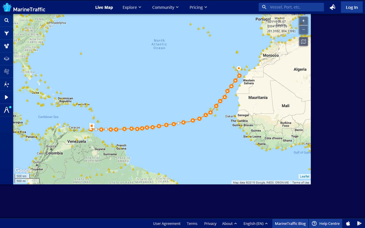
TRANSATLANTIC - This leg of the Atlantic could be where the world water speed record for solar boats is broken.
Air transportation is another example constrained by wind direction. Eastbound crossings over the North Atlantic and the North Pacific are shorter than westbound crossings because of the cumulative wind effect. For example, a flight between New York and London is scheduled to last about 7 hours (from gate to gate) eastbound and about 7 hours and 45 minutes westbound. The scheduled difference of 45 minutes is the outcome of dominant winds. The westbound transatlantic flight consumes more energy than the eastbound flight.
WP3. PLATFORM BUILD WP4. GIS, GEOSPATIAL AI INCORPORATION WP5.
SATELLITE CYBER SECURITY, CLOUD, IoT
WP11. ONBOARD/OFFBOARD VESSEL SECURITY WP12. AUTONOMOUS CIRCUMNAVIGATION ATTEMPT WP13. COLREGS COMPLIANCE LAW & LOBBYING
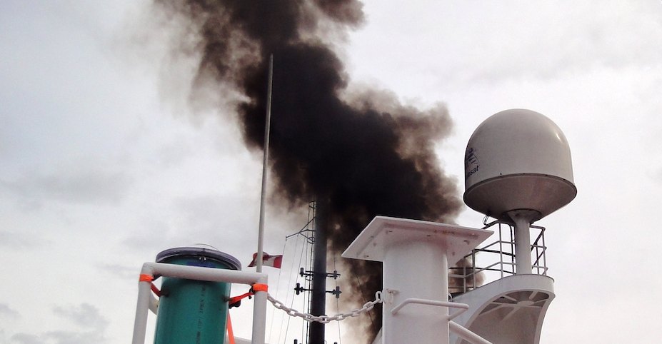
The Cleaner Ocean Foundation works to help protect the "seven seas" from the effects of anthropogenic atmospheric pollution like this ship that is belching diesel fumes like there is no tomorrow. We'd like to preserve tomorrow for our children. You can help us to make this scene a thing of the past.
Between 1451 and 1506 Christopher Columbus tried to investigate water movement in the sea. During his exploration mission, he used vessels to sail across various areas, namely the Canary Islands to the Bahamas covering 5400 miles, a voyage of around 36 days.
During this period, also known as the Age of Sail, other explorers like Vasco Da Gama were unknowingly assisted by these winds to discover new lands and even a route to India. He sailed between July 1497 and May 1498 and was instrumental in humans conquering the sea. The Portuguese and Spanish traders soon realised that the prevailing north easterlies of the mid latitudes could blow a ship across the Atlantic Ocean, and even better, the south easterlies on the other side could blow them back again. It was not luck, it was a natural phenomena.
With the advent of the ages of steam and later technologies, we have almost forgotten the role that the Trade winds.
Officers on board sailing vessels maintained detailed logbooks of the ships’ activities. These observations, which could be made several times per day, mostly included the ship’s position and weather conditions (temperature, wind intensity, and direction). Their main purpose was to assist navigation, particularly since it was difficult to accurately estimate the longitude.
Other explorers added weight to this research, among them a Norwegian called Thor Heyerdahl, in 1947 with his Kontiki and later Ra expeditions, discovering that trade winds are capable of blowing a balsa raft from South America to the Tuamoto Islands, and a reeds floater from Egypt to America.
WHY ARE WE DOING THIS?
Because we can, and because we can, we must.
|
|
|
Please use our A-Z INDEX to navigate this site
This website is Copyright © 2020 Jameson Hunter Ltd
|